India's Monsoon Activity Has Increased, More Rainfall Likely: IMD

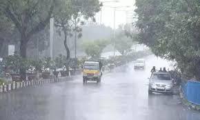
Due to a cyclonic circulation, the India Meteorological Department (IMD) has projected significant rainfall throughout eastern India on September 18 and 19. The circulation is expected to form over the north Bay of Bengal on September 17, according to the IMD. The meteorological service also predicted that north and central India - Madhya Pradesh, Uttar Pradesh, Uttarakhand, east Rajasthan, and Gujarat - will see heavy rains through Thursday.
"Rains activity is expected to intensify over Odisha and Gangetic West Bengal on September 18-19, with moderately widespread to widespread rainfall and isolated heavy, falls over above regions," the IMD said. It further stated that rain would be scattered to moderately widespread throughout northwest India (excluding Jammu & Kashmir, Ladakh, and Himachal Pradesh) till September 17.
The country's monsoon activity has increased, reducing the country's rain deficit to 5% from 9% at the end of August. Monsoon rains are approaching typical levels, which range from 104 percent to 96 percent of the long-term average. Meanwhile, the meteorological service has issued an orange signal for Delhi, warning of heavy rain on Thursday.
An orange alert is issued as a warning for exceptionally severe weather with the possibility for commute disruption due to road and sewer closures and power outages. So far this monsoon season, the capital has received 1,146.4 mm of rain, the greatest in 46 years and nearly double the amount recorded last year.
The Safdarjung observatory, which serves as the city's official weather station, recorded 1,150 mm of rain during the monsoon season in 1975. Delhi has received 390mm of rain this month alone, making it the second rainiest September since 1901. The greatest total for this month was 417.3mm in September 1944.


